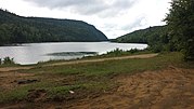
Seigneurie of Batiscan
Historical seigneurie in Quebec, CanadaThe Seigneurie of Batiscan was located on, and included 1/2 lieue of frontage along, the north shore of the St. Lawrence River in the province of Quebec, Canada. It was 20 lieues deep. Granted in 1639 to the Jesuits, colonization of the manor began in 1666, after an initial allotments were added to the census in 1665.) The northern boundary of the seigneurie was past the source of the Saint-Maurice River. It was the deepest in the seigneurial system of New France. The seigneurie of Batiscan became the most populous governed area of the Three Rivers by the end of the 17th Century.
Read article
Top Questions
AI generatedMore questions


